All stations, all stations...I’m writing this article while swinging on a mooring in the south-west anchorage of Anegada in the British Virgin Islands.
Named by Christopher Columbus in 1493, Anegada means drowned in Spanish. With more than 300 shipwrecks on the reefs surrounding the island, her name was well chosen. Located about 15 nautical miles north of Virgin Gorda, this 12x3-mile strip of sand, scrub brush and coral has a storied past, filled with Spanish treasure galleons blown off course and sent crashing onto her dangerous reefs.
With the exception of a narrow entrance on her southwest side, the island is basically surrounded by the world’s third largest barrier reef. Couple this with the island’s low profile on the horizon — only 28 feet above sea level — and a trip to Anegada had been off limits to charter boats for years because of the very real possibility of adventures going horribly wrong.
However, with the advent of accurate GPS and the use of modern chart plotters, trips to this beautiful island are now a much simpler affair.
Known throughout the Virgin Islands for her expansive beautiful beaches, we decided to leave the volcanic islands of the rest of the British Virgin Islands and explore this quiet sandy place of less than 250 inhabitants.
So, with the hot Caribbean sun slowly climbing higher in the morning sky, we slipped our mooring at the Bitter End Yacht Club on Virgin Gorda and pointed our bow north. Clearing Necker Island on our starboard side, we settled into a close reach with the warm, constant easterlies pushing us on toward our destination — the island with a dangerous past, Anegada.
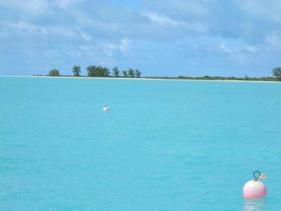
Our 50-foot Voyage catamaran made for a quick and comfortable sail across the sparkling turquoise waters of the eastern Caribbean Sea. The total trip was just over two hours, but because of the island’s low elevation, we were almost an hour into our sail before we could find Anegada on the horizon.
As the island slowly came into view we could see that we were going to be caught by a typical Caribbean afternoon rainstorm. Firing up the twin diesels the crew rolled in the genoa to prepare for the onslaught and we began motor-sailing through the building ocean swell.
As the squall bore down, the wind picked up from a benign 12 knots to a gusty 25 plus and the rain pelted us in sheets. Almost instantly Anegada disappeared from view. Suddenly we became keenly aware that with just a little nasty weather, this island, with it’s low elevation, reefs and sand bars, could be a dangerous place to visit.
I guess old Chris was right about the name after all. Within 20 minutes the squall blew itself out and as the swells diminished the island slowly came back into view.
Approaching the narrow entrance to the harbour, we were surprised to find the chart and the private navigational buoys did not completely agree. To make matters more interesting, the shallow water here was not the typical crystal clear fluid that we were accustom to but uncharacteristically murky and the bottom was difficult to see. As we slowly negotiated our way to the mooring field, the island’s history had us double-checking the chart plotter and depth gauge, but in short order, we were tied to a mooring alongside a couple of dozen other boats.
Leaving our vessel, we took the bumpy 10-minute taxi ride to the north side of the island. The sparkling sand beach we found was deep and spectacular, protected by a massive reef. The snorkeling along the edge of the reef was pretty good but lets face it, on Anegada, it’s all about the beaches, so off we went.
With only the sound of the mountainous waves crashing over the reef, my wife and I walked alone in the soft sugar sand and the rest of the world just melted away. Later, we returned to the south shore and again we strolled quietly along another lonely strip of beach. On this side of the island, the sand was almost white in colour with the texture of finely ground flour. Alone on the beach, we felt like the Robinson’s on a deserted island.
Back on the boat, everyone agreed that the true beauty of Anegada lay in the quietness and solitude that can be found while strolling the numerous beaches on this island that Christopher Columbus dubbed “the land of the drowned.”
Until next month, this is Capt’n D clearing to channel 16.
Dennis Centis is a member of the Little Current Yacht Club, and has chartered bodies of water around the world, including the Mediterrenean, the Bahamas and Caribbean, as well as the North Channel and Georgian Bay.
Posted by Laurel Myers