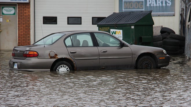
Traffic is slow going as the curb lanes heading north and south on Notre Dame in that area are affected by the flooding.
Drive with caution.
Heavy rains today in Greater will turn to freezing rain or snow, Environment Canada warns, and, combined with the still frozen ground, concern is increasing about potential flood risks.
The Nickel District Conservation Authority warned Monday that water levels have risen substantially in some areas, increasing flood worries even more.
Most of the rain can't be absorbed into the ground, and will instead add to the spring runoff as the late spring this year picks up momentum.
Temperatures will drop to -1 C later today, with scattered flurries expected overnight, when the mercury will dip to a chilly -9. It will stay cold, with a high of -4 C on Tuesday and 1 C on Wednesday. Highs around 9 C return later in the week, with more rain forecast on Saturday.
Residents living in low-lying areas, and parts of the city historically at risk of flooding, should keep an especially close eye on flood conditions. Large rivers that run into the city – including the Vermillion, Onaping and Wanapitei – will definitely be affected, the Authority said in its release.
Join Sudbury.com+
- Messages
- Post a Listing
- Your Listings
- Your Profile
- Your Subscriptions
- Your Likes
- Your Business
- Support Local News
- Payment History
Sudbury.com+ members
Already a +member?
Not a +member?
Sign up for a Sudbury.com+ account for instant access to upcoming contests, local offers, auctions and so much more.